
Geomatics ? What is it ?
We've never heard of it, but it's all around us !
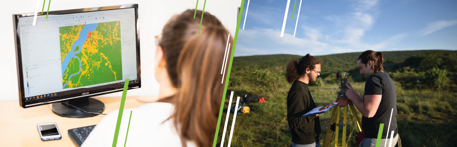

Geomatics is where the geographical sciences meet information technology.
It encompasses a range of technologies for modelling, representing and analysing the territory to produce virtual representations: geolocation, spatial imagery, databases, GIS (Geographic Information Systems), Web technologies, etc.
Geolocation
Geolocation is an essential tool for locating an object anywhere on the planet. It is now widely available, with accuracy ranging from around ten metres for the consumer applications found in our smartphones, to a few millimetres for scientific applications
For example, when it comes to improving the operation of urban services, geolocation can be used to improve the organisation of waste collection rounds, the positioning of urban lighting and the management of water networks. The data collected can also be used to develop new transport services or to manage traffic flows at events such as the Olympic Games.
Areas of activity :
Transport and logistics, navigation and mapping, traffic forecasting and route optimisation, natural resource management, etc.
Contributing to risk prevention
Geomatics specialists play a key role in protecting the environment. Their expertise in modelling and representing spatial and temporal changes in the environment is invaluable.
For example, when setting up infrastructures such as wind farms or solar power plants, it is the geomatics expert who optimises their positioning by simulating their performance in terms of relief, local weather conditions and their impact on the landscape and biodiversity. They can also help to preserve natural areas and prevent fires by using geospatial tools to identify areas at risk and plan protective measures.
Areas of activity :
Renewable energies, natural resource management, regional and urban planning
Artificial intelligence and geomatics
Geomatics professionals use artificial intelligence techniques to analyse the aerial and satellite images and radar data they collect, and to automatically extract the relevant geographical information from it
Variations in altitude between two surface models can reveal new buildings, melting glaciers or landslides. Photogrammetry is used to calculate these models. It also enables aerial or satellite images to be overlaid onto a map (known as ortho-rectified images).
Land cover (artificial areas, crops, etc.) can be identified automatically using machine learning algorithms (convolutional neural networks) operating on ortho-rectified images. With the proliferation of sensors and computing power, the geomatician is at the heart of monitoring the ecological and climatic transition, offering diagnoses that guide public decision-making.
Les géomaticien·ne·s dans la sauvegarde du patrimoine
Experts in geomatics play a key role in collecting and 3D-modeling vast territories for mapping, analysis and preservation. These skills can also be put to good use in documenting monuments for conservation and development purposes
For example, Mont-Saint-Michel has been modelled in 3D by geomaticians. This modelling helps to better gather information and understand its structure and architecture, thereby contributing to its preservation by providing accurate data that can be used to plan conservation work.
Areas of activity:
Geographic Information Systems, archaeology and cultural heritage, monument restoration and conservation, heritage risk management, heritage documentation and inventory